Landscape and History of Rowney Green
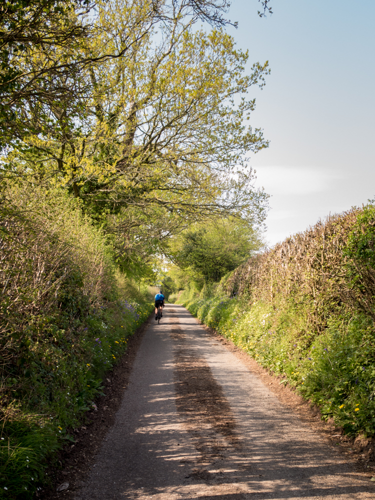
Cycle Tour
To fully appreciate the landscape and history of the nearby area, why not click this link to view a local cycle tour ?
Geology
The high ground of Rowney Green was formed by a terminal moraine in the last ice age between 18,000 and 14,000 years ago. The glacier had carried rocks, gravel, sand and clay with it as it drifted along. By the time it reached this area, the atmosphere was sufficiently warm for the ice to melt. The drift material was then deposited onto the underlying Keuper Marl; the stones you see all around you therefore could have broken off rocks hundreds of miles away.
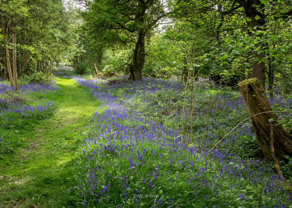
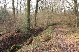
Peck Wood
Peck Wood contains a large area of ancient woodland and ancient wood pasture. It has been woodland for about 10,000 years; ever since trees started to grow here after the last ice age. It gives food and shelter to a large variety of wildlife. It is bisected by a very well preserved section of the boundary ditch and bank of Alvechurch Park. It was given to the Methodist Church in 1948 to provide holidays, training and education opportunities for children, young people and the general community. The facilities may be booked.
Newbourne Wood
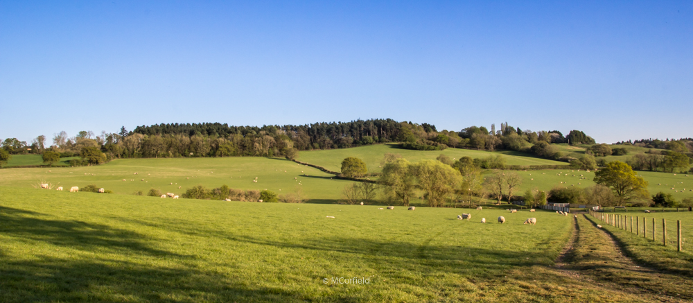
Newbourne Wood is 11 acres and was donated to Worcestershire Nature Conservation Trust (now Worcestershire Wildlife Trust) in 1970 by Mr and Mrs Christopher Tangye, members of the Cadbury family who lived at Rowney Lodge Farm. In 1958- 1959 they had it planted with larch, pines, oak, beech, chestnut, and Douglas fir after the area had been quarried for sand and gravel. Since then the Trust has been gradually thinning and harvesting the conifers for timber. During 2014 the conifers in the northern third of the woodland were all felled and it was replanted with saplings so that eventually a deciduous wood will be established.
Rowney Green and Alvechurch
Rowney Green means “Rough Hay” and is in the parish of Alvechurch. It was originally in the forest of Feckenham.
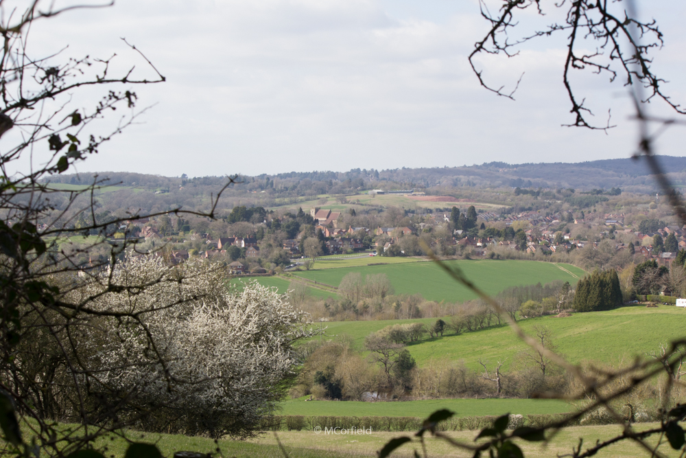
Looking across the valley from Newbourne Wood to Tardebigge Church and the Lickey Hills, you can see the village of Alvechurch, once an important medieval town, which was first mentioned in written records in 780. The River Arrow rises in the north of the parish and in former times it provided water for fishponds and power to run a number of mills in the area, some of which still exist (notably Forge Mill, now part of the National Needle Museum).
Rowney Green was open common land until the 19th century Enclosures Acts. During the 19th century many of the people in Rowney Green worked in the needle mills of Redditch. The public footpath from Rowney Green across Bordesley Park was then known as the Needlemakers’ Path. There are forty listed buildings in the village and the parish, showing a gradual development through the centuries. The most famous of these is Seechem Manor, dating from medieval times.
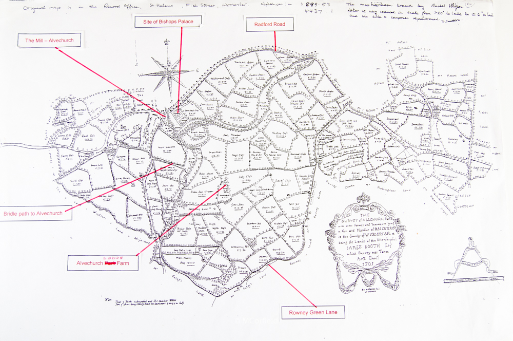
The Medieval Park of Alvechurch
The Bishop of Worcester built a wooden palace in Alvechurch in 1168 and fenced off about 3 km2 to keep fallow deer. The estate manager (the ‘parker’) probably lived at Alvechurch Lodge Farm. This is on relatively high ground where most of the park and field systems can still be readily identified. An inner ditch and a bank a-topped with a stout wooden fence kept the deer from jumping out.
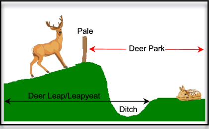
Remnants of the bank can still be seen as you walk along Rowney Green Lane, in various parts of the village of Alvechurch, in Peck Wood, at the end of Newbourne Wood and near Longfield Manor.
The Medieval Park of Bordesley
Bordesley Abbey, a Cistercian monastery just in present day Redditch whose foundation stone was laid in 1138, is a valuable archaeological site. The southern boundary of Alvechurch Park is shared with the northern boundary of Bordesley Park whose western boundary follows the river Arrow from Lye Bridge southwards, while the eastern boundary follows Dagnell Brook from Lower Rowney Green and Pot End to the Arrow in Redditch
The Calling Oak in Rowney Green Lane marks the park’s most northerly point. Until the early 20th century there was a stone building close-by which may have been a shelter for monks or others
The Spinney (behind the houses on the eastern side of the lane) was once called “The Lynch”, later Lych Meadow, then Lydd’s meadow.
In this meadow wild king cups, wood sorrel, bluebells, ransoms, celandine and lords and ladies still grow.
In 1538 Bordesley Abbey was surrendered to Henry V111 who gave the estate to a Roman Catholic family, the Windsors (ancestors of the Earls of Plymouth), in return for seizing their estate near Staines.
Circa 1930, a tryptitch (a travelling altar used by priests at the time of the Reformation) was found hidden in a large cavity situated at The Homestead at the bottom of Gravel Pit Lane on the boundary of the Bordesley estate.
The Roman Road
Icknield (or Rycknild) Street passes along the eastern edge of Rowney Green, linking Redditch with Forhill on the North Worcestershire path. For most of its length it is a country lane – a hollow way, as indeed is The Holloway which connects Rowney Green to the Redditch Road. The hollow way was a track along the boundary between two landowners. Each landowner dug out a ditch and threw up the earth into a continuous bank along his own side. This formed a track several feet below the level of the field on either side.
Icknield Street was the main route from Cirencester, forking left from the Fosse Way near Stow-on-the-Wold through Alcester, then Streetly (near Sutton Coldfield) to Watling Street at Wall (the A5) and then on to Derby and the north. Folk memory identified Barton Farm as a coaching inn when it was still a main route in later centuries.
The field systems
The fields in the neighbourhood have been somewhat enlarged since the 2nd World War, but aerial photography suggests that many of today’s hedgerows follow very ancient field boundaries. Indeed, it has been established that much of the English countryside (such as the sites of farm dwellings and field boundaries) has not changed since before Roman times. This suggests that the landscape of pre-historic Alvechurch might still be recognisable today. Storrage Lane is part of the old salt way used by pack-horses carrying salt from Droitwich, over Cobley Hill and continuing to the east.
Eighteenth century maps describe field boundaries which can be identified with existing hedgerows and hedgerow trees. Although farmers have removed numerous hedges in recent years to enlarge their fields, sometimes isolated trees are left, so marking the hedge-line of former fields and particularly the deer park boundary.
Additional information
You can find more village history with these links :
Village Hall
Chapel
A great deal of other photos and documents about the village have been produced by residents over many years. These have been indexed and digitised and are available on request – email rowneygreenorganisation@gmail.com.