Bromsgrove District Plan Review
(Initial proposal for building 9000 homes)
Bromsgrove District Council (BDC) is in the process of reviewing and replacing the Bromsgrove District Plan (adopted January 2017), which will set out where new housing, employment and other development alongside its supporting infrastructure will take place over the next 15 years or so.
As part of this review, BDC has announced draft plans to build 9,000 new homes. It is intended to finalise the plans by 2028. They have launched a consultation platform and request all residents to view and respond by September 22nd 2025.
In addition, Alvechurch Parish Council have requested residents to share their views by 7th July 2025, using their short questionnaire – https://forms.office.com/e/UHmTyb7qUy
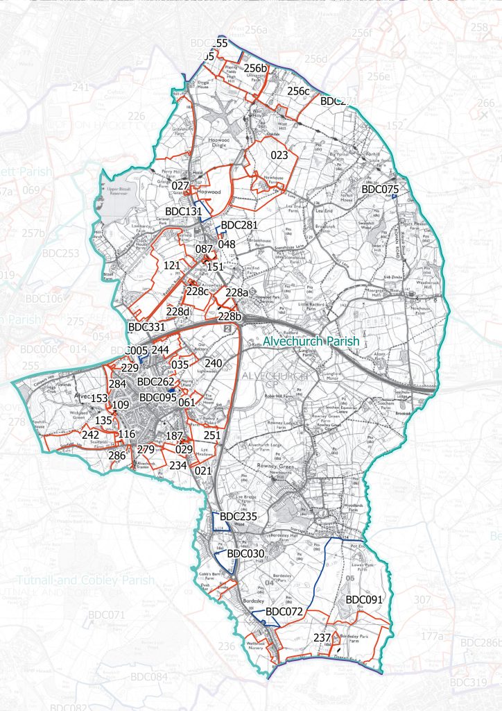
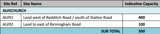
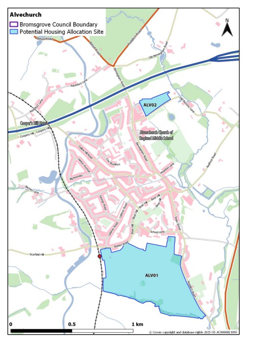
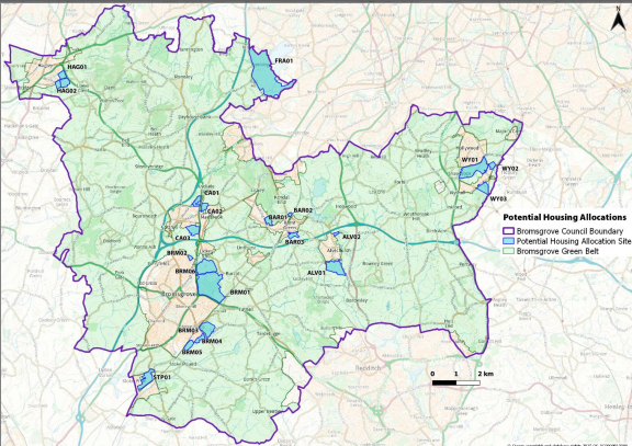
The proposed allocation for Alvechurch can be seen below :
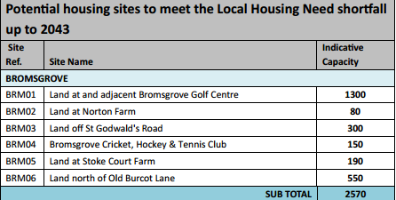
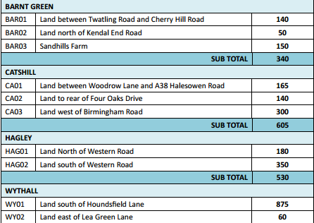
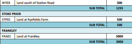
The proposals for Alvechurch should be compared to those for other areas in the district :
A consultation period will run from 30 June to 22 September 2025. Further updates can be checked on the council website
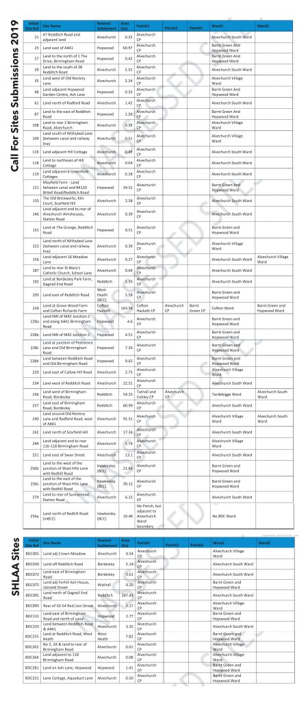
Sites reviewed by BDC before their choice of ALV01 and ALV02